01
National and global events
From the Molson Indy (1990–2004) to Olympic preparations and the 2010 Games (2003–2010), and on to the 2026 FIFA World Cup, the northeast lands have repeatedly stepped up as Vancouver's stage for the world.
Communities Concord Pacific Place
Concord Pacific Place
The former Expo lands
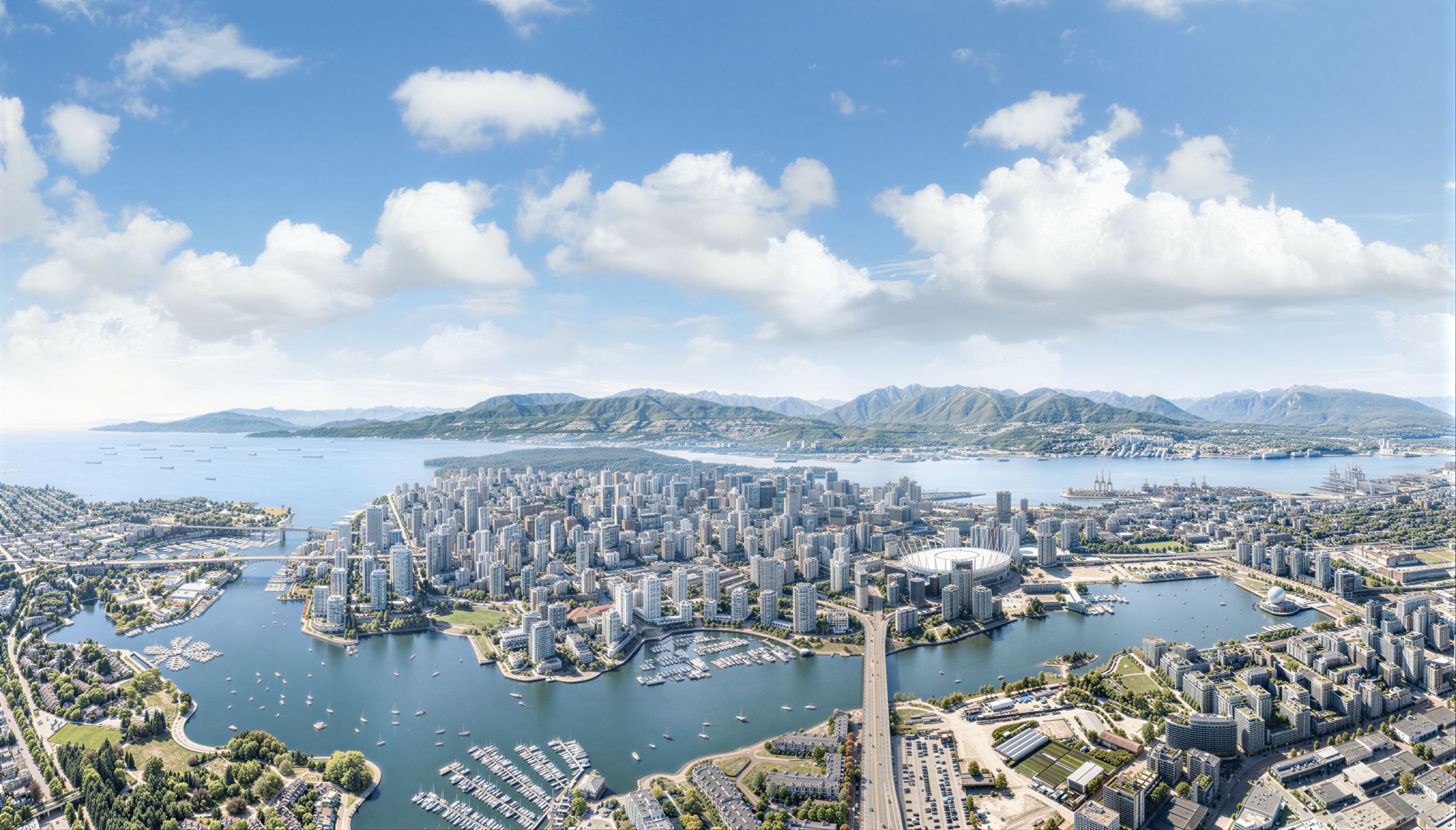
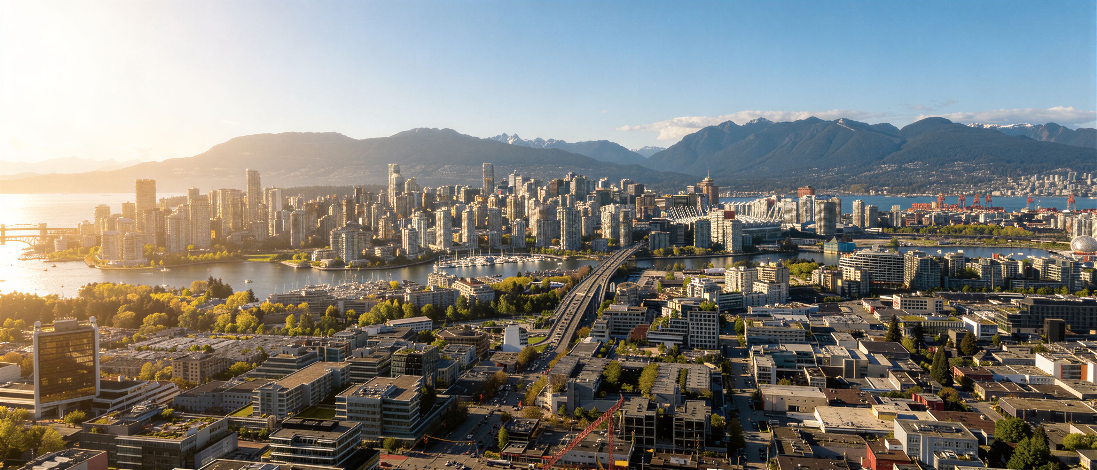
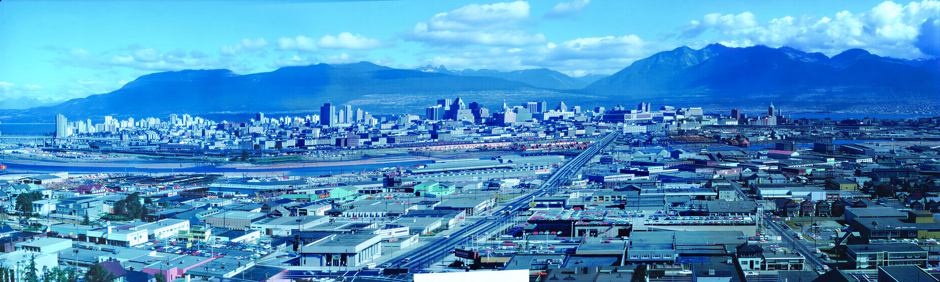
In the 70's, the north shore of False Creek was contaminated, smoggy and severed from the city. Today it is the international benchmark for how to build a community. This is the story of how it happened, what it gave back, and the one chapter still unwritten.
Where the project stands today
The transformation
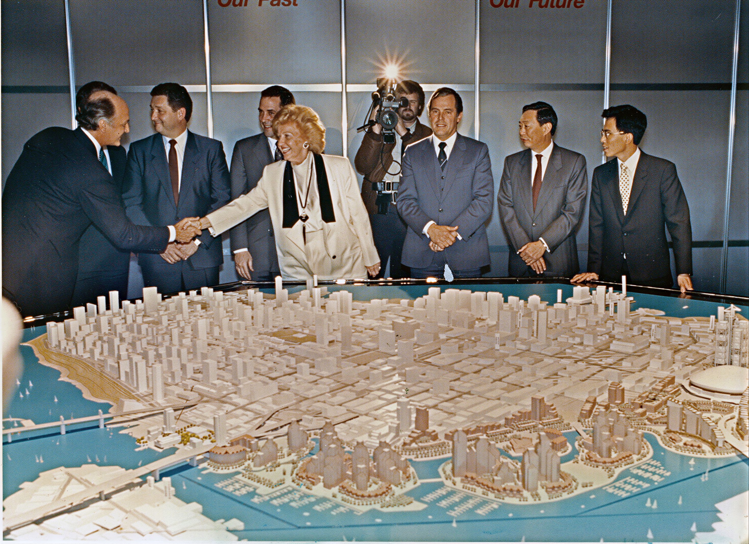
How it began
What was built
8 Neighbourhoods built
Tap any thumbnail to browse the catalogue
Concord Pacific Place is more than a community. It is the original model for an urban planning paradigm known the world over as Vancouverism: a high-density, mixed-use form that emphasizes sustainability and maximizes livability. The design language was set here, and it has been replicated across continents.
With Concord Pacific in the lead, innovation was always the order of the day. The first Lagoons Plan proposed a series of islands linked with bridges, an idea that might have helped clean the inlet by increasing water flow. Subsequent plans, developed in cooperation with the City and with input from thousands of public participants, concentrated on outcomes that would preserve the existing line of the waterfront and maximize public access through the site and along the seawall.
The False Creek North Official Development Plan broke the 204-acre Expo site (164 acres of land, 40 acres of water) into eleven neighbourhood parcels, from Beach and Roundhouse in the west to the culminating Concord Landing neighbourhood in the east. Even in and around three small parcels sold to other participants, Concord assumed responsibility for co-planning and for the development of services, roads, and the public realm for the Arena site and International Village.
A once-in-a-lifetime consensus in the history of Vancouver.
In four short decades, Concord employed tens of thousands of workers, earning billions of dollars in wages, to build more than 11,000 homes and social housing units. The neighbourhoods are filled with parks and playgrounds, linked by pedestrian paths and a critical connection in Vancouver's 30-kilometre seawall. A community centre, school sites, and daycares followed; the mixed-use form ensures that all residents are within easy walking distance of the services necessary for day-to-day life.
Beyond the master plan
Eleven thousand homes was only the start. Concord's contributions reached well past the parcel lines — into affordable housing, citywide recreation, and the venues the rest of Vancouver depends on.
Returned to the city
Land always in use
01
From the Molson Indy (1990–2004) to Olympic preparations and the 2010 Games (2003–2010), and on to the 2026 FIFA World Cup, the northeast lands have repeatedly stepped up as Vancouver's stage for the world.
02
The Concord Pacific Dragon Boat Festival, Run for the Cure, the Tour de Concord, Lululemon yoga, and Vancouver Pride. The Four Fires Indigenous Festival, Canoe Cultures, and the Canadian Red Cross have all brought the community together on the northeast lands.
03
On the site where Concord Landing will eventually stand. The pop-up draws more visitors than even the much-loved George Wainborn or Coopers' parks — and Concord Pacific funds its half-million-dollar annual operating budget.
A global model
Concord Pacific has hosted Cornell University's Baker Program in Real Estate, visiting planners, government delegations, and universities the world over, who come to study the original example of the Vancouverism planning paradigm in Concord Pacific Place.
Cities and districts that have adopted elements of the Vancouverism model:
The final chapter
Concord Pacific is eager to complete this city-changing project with a culminating stage that will also restore historic connections long broken in the city. The principal obstacle, blocking access to False Creek and delaying construction of the ninth and final neighbourhood, is the complex and controversial status of the Georgia and Dunsmuir viaducts.
These two raised roadways, opened in 1972 as part of a planned freeway from downtown to Highway 1, sever a stretch of the city from downtown to Strathcona, separating Chinatown and Gastown from False Creek. Aside from their lost purpose and their obstructive presence, the viaducts are also seismically unsound, a danger in even a moderate earthquake.
Since before the 2010 Olympic Games, Vancouver's City Council has been working on plans to remove the viaducts and restore the connection. From 2011 to 2015, council and staff held public consultations and confirmed the viaducts were near the end of their life. In 2015, a City plan was reported with an estimated cost of $200 million. A planning and consultation process followed, including more than 17,000 residents, with results released in 2017.
The City presented the $200-million budget to the five affected landowners — Concord Pacific, Canadian Metropolitan Properties (Plaza of Nations), BC Pavilion Corporation, Aquilini (Arena Lands), and the City itself. Staff affirmed that costs would be recovered from development contributions and from sales or leases of City land freed by the viaducts' removal. All landholders began rezoning their sites, releasing preliminary plans that acknowledged the expectation. Canadian Metropolitan Properties' conditional rezoning in 2018 included a $100 million community amenities charge designated for viaduct removal.
Concord itself has already made a $110-million contribution that the City said it was allocating to the removal of the viaducts.
Unfortunately, the City's own process stalled. Some estimates for removing the viaducts and building the replacement roadworks have quadrupled from the original $200 million. The viaducts are in the last few years of their life, and they remain vulnerable to catastrophic damage in a moderate earthquake. They also continue to stand in the way of any resolution that would let Concord proceed with Concord Landing.
Concord remains committed to proceeding as soon as the City clears the way. Concord is the only landholder with active Northeast False Creek plans. We understand that the City is now seeking Provincial and Federal loans to expedite removal of the viaducts, and we hope for early success or for another solution that recognizes the urgency and the potential of the work to follow.
It will clear a path for our own culminating challenge: the building of Concord Landing — one last exemplary neighbourhood and one more critical connection between False Creek and the larger community, continuing the urban fabric and fully realizing Concord Pacific Place on the Expo lands.